• If you have a mod, tool or prefab, please use the Resources section. Click Mods at the top of the forums.

KingGen - A Random World Generator for 7 Days to Die

I was Generating some random maps in different configurations and encountered this in the Large Mountains setting. 
Not all of them are like this, but most.  checked in game and all of them are at elevation 230, so I guess something needs to be tweaked either to allow it to keep generating terrain higher or to limit it to that height but without creating those flat areas. 
maybe lowering the base terrain to allow higher peaks would help.

image.png

image.png

 
Hi, I was just wondering if the kinggen software prefers 8 or 16bit maps for smoothing? I seem to be having issues getting the software to create smooth slopes. They mostly seem to be stepped. I wondered if it was perhaps better to use an 8bit height map so the kinggen software knows to apply more intense smoothing? 

Not sure if this is making sense? Happy to explain further if I can. 
If you supply KingGen with a 16 bit heightmap, no smoothing is done to it. It is your job to provide a smooth file. If you are experiencing stepped terrain, it is because you have supplied a stepped heightmap.

If you supply KingGen with an 8 bit heightmap, then KingGen will smooth it out to fill out the full 16 bits.

 
Ah that's great. Thank you. I suspected the smudge tool in gimp was creating steps but wondered if there was something in your software that would soften them. Thanks for the reply. 

I have another question if that's ok? 

Would you know the colour code for the lowest point that cities would spawn? I'd like to start my own height map ensuring cities can spawn all over, then add mountains and valleys manually.

Sorry for all the questions. 
In KingGen cities generally spawn between level 50 and 70. Ideally you would create flat regions around level 60 if you are using 8 bits.

If you are using 16 bits, than it should be 60 x 256, which is equal to 15360.

Depending on the software that you are using for drawing you have to figure out if the number is from 0 to 255 or from 0 to 65536.

 
So if the height map runs from 0 to 256, a height of 60 would simply be 60,60,60 as 0,0,0 is black and 255,255,255 is white? Roughly? Maybe?

Tested that just now. Yes that works great. So just to confirm, 60,60,60 in terms of rgb255 is a comfortable height for spawning of cities.

Thanks for your help and thanks for developing this software. Next to play with painting cities. 
Yes 60 is good. However you should be working in grayscale, so you should not have 3 channels (rgb) but only 1 channel for white. Perhaps the software you are using allows you to export the image in grayscale, so that's not a problem.

 
Yes, I'm just trying 'gimp' and that has an option to export 8bit,16bit gray. Also let's me do layers so I can mark out biomes according to the shape of the terrain on layer 2, export as colour png, then a third layer with buildings etc. This is great fun. Thanks for this. 

 
Last edited by a moderator:
Hello.First of all, thank you for your work, RWG already has impressive functionality.
And now, please tell me where I made a mistake and what needs to be corrected.
I wanted to make a custom map of biomes and drew 5 islands with different biomes in photoshop,everything came together in colors,but I don't understand how to make water.What color do you need?
Instead of water, a continuation of the forest biome is obtained.
Thanks.

e1501d6f9e80.jpg
7247e5c15072.jpg

 
Last edited by a moderator:
From what I've learned so far, it looks like you've allowed the software to generate the terrain. You've only specified biomes. I think you'll need to generate a height map that has the areas that you want as water. Someone more knowledgeable than me will help you shortly I'm sure. 

 
Hello.First of all, thank you for your work, RWG already has impressive functionality.
And now, please tell me where I made a mistake and what needs to be corrected.
I wanted to make a custom map of biomes and drew 5 islands with different biomes in photoshop,everything came together in colors,but I don't understand how to make water.What color do you need?
Instead of water, a continuation of the forest biome is obtained.
Thanks.
Hi, here are 2 tips that will help you:
 

1) in the biomes map, anything that you leave empty will become forest. Keep this in mind

2) the biomes map has nothing to do with water. If you want to set water, you have to paint your own heightmap. In a custom heightmap, anything below level 43 will become water

 
I have issued about custom heightmap I was edited bit lighting up when generator UK map went sunk under water because after generator adjust itself on brightness too dark heightmap make low land. I have no issued with NitroGen didn't change adjust brightness just stay same. After generator look weird map UK sunk into water.

7DtD bug 1.png

7DtD bug 2.png

 
Hi, here are 2 tips that will help you:
 

1) in the biomes map, anything that you leave empty will become forest. Keep this in mind

2) the biomes map has nothing to do with water. If you want to set water, you have to paint your own heightmap. In a custom heightmap, anything below level 43 will become water
I drew a height map and a corresponding biome map.
Same size 8192x8192 8bit
height map Grayscale
RGB Biome Map
 

d836a1c07e31.png


43968ab6eb8a.png
When generating height map, everything is OK,but when generating biomes, an error occurs::

" Traceback (most recent call last):
 File "gui.py", line 1240, in generate
 File "ntime.py", line 11, in ntime
 File "world.py", line 1011, in run
 File "world.py", line 197, in generate
 File "world.py", line 799, in init_biomes_map
 File "world.py", line 812, in load_biomes
IndexError: too many indices for array: array is 2-dimensional, but 3 were indexed
"
What am I doing wrong?

 
Last edited by a moderator:
I drew a height map and a corresponding biome map.
Same size 8192x8192 8bit
height map Grayscale
RGB Biome Map


When generating height map, everything is OK,but when generating biomes, an error occurs::

" Traceback (most recent call last):
 File "gui.py", line 1240, in generate
 File "ntime.py", line 11, in ntime
 File "world.py", line 1011, in run
 File "world.py", line 197, in generate
 File "world.py", line 799, in init_biomes_map
 File "world.py", line 812, in load_biomes
IndexError: too many indices for array: array is 2-dimensional, but 3 were indexed
"
What am I doing wrong?
It seems like the biomes map you are using has a single channel. But it should have 3 (RGB)

 
Now there are no generation errors, but the final result looks like this..

The heightmap you provided is probably not saved in the correct format. It must be a grayscale, single channel, png. Also remember that anything below level 43 will be under water

 
I just trial & error now worked I been first time custom POIs with zoning is awesome look better than NitroGen was lack things just random & some spawn edge land was crappy & keep re-generation all time.

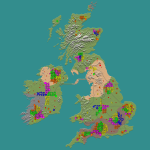
My first time tested UK map with KingGen 👍 & tweaked no POI blocked spawn on mountains preview.png

 
I just trial & error now worked I been first time custom POIs with zoning is awesome look better than NitroGen was lack things just random & some spawn edge land was crappy & keep re-generation all time.

My first time tested UK map with KingGen 👍 & tweaked no POI blocked spawn on mountains View attachment 20231

//quote

That looks great. I'm not having as much luck. I swear the city level adjusts by itself. Is that an 8k map? 
 
Last edited by a moderator:
Hi.

This time I was testing the No POIs feature, and it effectively won't place any POIs in the demarked area... but it also won't place any POIs anywhere else (other than wilderness ones) Is there any other colour we are supposed to fill the file file with for KingGen to generate cities in the rest of the map? or it only works if I also made the custom cities. 

Maybe the no POIs feature should be in the zoning file instead of the Cities file?

cheers

image.png


Cities.png

 
Back
Top