• If you have a mod, tool or prefab, please use the Resources section. Click Mods at the top of the forums.

What's the best height map editor you have found for making custom maps in 7d2d?

warmer

Well-known member
I started playing with Terra Firma - free little game/utility on steam that uses plat tectonics and erosion to simulate geology in a really cool and detailed way. I wish I could export a height map from something like this to use in 7d2d because it feels so organic due it it not using noise and stamps for the features. 

Does anyone know of a similar utility?
What's your fav one to use for height map?

This is a quick example of what you can do really quickly the fact that you control two colliding continental plates angle and speed to create mountains is just so cool to me. I added a couple of call outs on the first pic if you aren't familiar with how it works. You just adjust these settings, and hit go. it moves them according to the angle and speed and crumples into mountain ranges. Then you can then control the erosion via weather patterns/ stone type. Even allowing you to add/subtract or even create volcanoes or dig out and add lakes as it progresses through a timeline. It's super intuitive and simple. Wish we could get something like this to make custom maps. If anyone know of a similar utility that will give you a 256 greyscale heightmap export please let me know.

image.png


image.png
image.png

 
Last edited by a moderator:
I just got word from the developer that in their next release, Terra Firma 2, they will have 256 greyscale heighmap export!!! :)  Perfect for some map utilities. I am PUMPED!

 
I just got word from the developer that in their next release, Terra Firma 2, they will have 256 greyscale heighmap export!!! :)  Perfect for some map utilities. I am PUMPED!
Note that 256 grayscale is 8bit.  That will be a Minecraft map.  You really need 16bit for this game.  It may be useful in some apps, but your results may not be great without a lot of smoothing.

As far as apps to make maps, I've used World Machine and it works well, though it can take some work to figure out.  Unfortunately the free version is only about a 1k map size, and I don't remember if it is 8bit output or 16bit output.  I've heard Gaea is good, but haven't tried it.  And, of course, Teragon makes heightmaps that are more suitable for this game, but not quite as interesting as ones that just make terrain without caring about having places for towns and POI and roads.

 
Last edited by a moderator:
Note that 256 grayscale is 8bit.  That will be a Minecraft map.  You really need 16bit for this game.  It may be useful in some apps, but your results may not be great without a lot of smoothing.

As far as apps to make maps, I've used World Machine and it works well, though it can take some work to figure out.  Unfortunately the free version is only about a 1k map size, and I don't remember if it is 8bit output or 16bit output.  I've heard Gaea is good, but haven't tried it.  And, of course, Teragon makes heightmaps that are more suitable for this game, but not quite as interesting as ones that just make terrain without caring about having places for towns and POI and roads.
I hear you on the rough nature of it. The map utility I have used has smoothing/erosion, so it looks much better. I like 256 greyscale, because it's really easy for me to make custom edits using something like Gimp. Also 256 corresponds directly to the elevation in game so it's even easier for me to understand mentally. The map in Terra Firma is 100's of KM down to a much smaller size, and you can zoom into particular area to generate.

Just taking a look at world machine. Could you stitch 4, 1km together for a 2kmx2km map etc...? You'd have to ensure the borders are flat planes of a given height though. Can you define things like that, or is it all generated. OR.... Could you create a map that is purposely 16th scale in size/km2, but not height then expand the 1x1 to a 4x4 using nearest neighbor to smooth the gradient?

 
Last edited by a moderator:
I hear you on the rough nature of it. The map utility I have used has smoothing/erosion, so it looks much better. I like 256 greyscale, because it's really easy for me to make custom edits using something like Gimp. Also 256 corresponds directly to the elevation in game so it's even easier for me to understand mentally.

Just taking a look at world machine. Could you stitch 4, 1km together for a 2kmx2km map etc...? You'd have to ensure the borders are flat planes of a given height though. Can you define things like that, or is it all generated. The map in Terra Firma is 100's of KM down to a much smaller size, and you can zoom into particular area to generate.
I haven't used it in a long time, but you could certainly stitch together multiple maps in Gimp and use a tool to smooth the transitions if they aren't perfect.  How well that works would depend on the difference between the maps.  Maps are made using a series of commands in what is kind of like a flow chart, where each command does different things and has a lot of parameters.  I didn't play around with it a lot because it wasn't really what I was looking for at the time, but you could probably control the map edges.  I don't know for sure, though.

The map it makes could be considered to be 100s of km in size.  After all, you don't get mountain ranges in a 1km square.  It's just the exported heightmap that is 1k size.  I had tried resizing it, but resizing isn't a great option as you lose way too much detail.  Stitching them together would probably be the best option if you weren't interested in getting the paid version.

As far as it being worth using... that's really up to you.  I wasn't really interested in it because I was using Teragon and I had only been looking for options I might import into Teragon and then add stuff to, but the terrain was really not designed for having towns and stuff like I said, so I didn't keep using it.  But if you want to make a heightmap to start with and plan to edit it in Gimp, it's not hard to get some nice terrain.

Btw, in case you're interested, a map maker named Grimlock in the Teragon discord has posted a couple of things to help with grayscale and elevations.  One was a chart that showed the grayscale values for each elevation, and the other was a stamp that you could drop on a map temporarily that was set up to show the elevations of every 10m in a stair step layout, making it easy to get your major elevations correct.  Each had the elevation imprinted in the flat top of it so you knew which elevation you were looking at.  You could do something similar to give 1m elevations if you wanted.  That kind of thing would let you easily just use the eye dropper tool to get the exact color for any given elevation.

I happened to still have World Machine installed, so here's an example of a very basic map I had tried to make.  It's not super detailed because I had been trying to get space for towns and POI, but it gives you an idea of what you'd see.  I'm showing both the heightmap alone as well as a water level overlay to give an idea of what you might see if adding water at a certain depth.

image.png

image.png

 
Last edited by a moderator:
I use a combination of a few tools. Gaia for Unity is still the best, but has limitations and is tricky to export, its generally not smooth to use. More often, I use World Painter, which is a straight up Minecraft level editor, but does export .PNG files to 16bit. Ive made my own brushes and stamps from both paid and free assets in Unity.

Along with WP, i use Maptoolz in order to use POIs as stencils in world painter. I still use King Gen for terrain preview gens, also for stencil making, the preview shadows make drawing in roads very clear and easy. KG also has built in biome and splat fixes and creates waterinfo.xmls, which the game still processes the same as splat4.

Also use Krita, Gimp and Paint.net for biomes and splat3.

I just worked Teragon into my workflow and I was impressed with the out of the box presets for towns and cities. Looking forward to dialing some of those in further for great biome specific type towns and cities.
 

2025-02-28_00h24_11.png

2025-02-23_11h27_27.png

 
As far as it being worth using... that's really up to you.  I wasn't really interested in it because I was using Teragon and I had only been looking for options I might import into Teragon and then add stuff to, but the terrain was really not designed for having towns and stuff like I said, so I didn't keep using it.  But if you want to make a heightmap to start with and plan to edit it in Gimp, it's not hard to get some nice terrain.

Btw, in case you're interested, a map maker named Grimlock in the Teragon discord has posted a couple of things to help with grayscale and elevations.  
Teragon is what I tend to use because you can tweak so many aspects. I usually make my allowed elevation deviation fairly extreme for POI placement and let the town/POI generation smooth out the flat areas. I did miss the flexibility of Kingen for town layouts, if they could add that into Teragon, it would be my ideal setup for RWG+defined restrictions
 

Along with WP, i use Maptoolz in order to use POIs as stencils in world painter. I still use King Gen for terrain preview gens, also for stencil making, the preview shadows make drawing in roads very clear and easy. KG also has built in biome and splat fixes and creates waterinfo.xmls, which the game still processes the same as splat4.
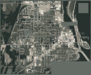
Love the ability to use real world geography Are your screenshots from Kingen with districts you layed out? What I wish I had was the ability to recreate my hometown in topography (lake/river/mountains) and layout (city districts) It's an 8,000 pop town that would be perfect for a 10km world that is 3/4 city

image.png

 
Last edited by a moderator:
Teragon is what I tend to use because you can tweak so many aspects. I usually make my allowed elevation deviation fairly extreme for POI placement and let the town/POI generation smooth out the flat areas. I did miss the flexibility of Kingen for town layouts, if they could add that into Teragon, it would be my ideal setup for RWG+defined restrictions
 

Love the ability to use real world geography Are your screenshots from Kingen with districts you layed out? What I wish I had was the ability to recreate my hometown in topography (lake/river/mountains) and layout (city districts) It's an 8,000 pop town that would be perfect for a 10km world that is 3/4 city

View attachment 33777
Teragon can do a lot of stuff for layout.  If you have something you think would be useful, you can always suggest it (preferably in discord or the Teragon thread in mods>tools).

That preview does look like Kinggen.

You can easily get any real world terrain online.  The difficulty is that it is usually 8 bit, which is a challenge to make look good in this game without losing a lot of detail.  Also, if the terrain is an area larger than the map, it compresses everything down to fit, and that can make it look strange and can make towns appear really large compared to the terrain.  The last main issue is dealing with roads and POI in town.  If roads are at an angle or are unusual in some way, making them work and making POI line up properly can be difficult.  And any bridges that are at an angle usually aren't going to work right.

But if you want to spend time working on it, you can at least get something that is usable.  Most work would need to be done by hand.

 
Last edited by a moderator:
@warmer

It can fit in a navezgane size map layout, as a hub
tiles needed 28 across 29 tiles height

8k would provide good wilderness

I have created a cleaner closely scaled street map, the 150x150 tiles should work for most of your blocks, though they will overlay 

for the wider city blocks. Riamus has a tutorial for laying out group tiles using Teragon. I may be able to make a starter heightmap 

for you, but I have never used tiles. This is what I figured out so far.

streets.png

 
Last edited by a moderator:
You are welcome, I have not finished yet, I will post some snaps in a few to show how far

I've gotten. but you will have to ask Riamus to show you how to build custom tiles.

This is a demo biome config, I surround the city with mountains, so you could import the mountains you designed.

warmerbiome4.png

This is the base biome, I tried to use the colors you had on the picture, sort of.

warmerbiome3.png

I reduced the color so you can get a good idea of tile building layout when you begin.

ptemplate.jpg

 
Last edited by a moderator:
Teragon is what I tend to use because you can tweak so many aspects. I usually make my allowed elevation deviation fairly extreme for POI placement and let the town/POI generation smooth out the flat areas. I did miss the flexibility of Kingen for town layouts, if they could add that into Teragon, it would be my ideal setup for RWG+defined restrictions
 

Love the ability to use real world geography Are your screenshots from Kingen with districts you layed out? What I wish I had was the ability to recreate my hometown in topography (lake/river/mountains) and layout (city districts) It's an 8,000 pop town that would be perfect for a 10km world that is 3/4 city

 
These are direct from WP, the KG looks like this. I quickly starting to prefer Teragon for the actual map previews, but with KG using nothing but forest biome i can accurate do to pixels level on roads.
 

2025-01-28_00h20_49.png

 
Last edited by a moderator:
These are direct from WP, the KG looks like this. I quickly starting to prefer Teragon for the actual map previews, but with KG using nothing but forest biome i can accurate do to pixels level on roads.
You could do a single biome map for that in Teragon if you wanted (Create Single Biome Map).  And later you can create a normal biome map.

 
Last edited by a moderator:
You could do a single biome map for that in Teragon if you wanted (Create Single Biome Map).  And later you can create a normal biome map.
I agree Teragon is more than capable, generation times for these height maps matter way way more than when actually making a populated height map. I might gen, modify regen and save 50-100 times in an hour, super basic but the shading is perfect and i can regen a png in about 25 seconds with waterinfo included.

 
I agree Teragon is more than capable, generation times for these height maps matter way way more than when actually making a populated height map. I might gen, modify regen and save 50-100 times in an hour, super basic but the shading is perfect and i can regen a png in about 25 seconds with waterinfo included.
Depending what you are needing to do when regenerating a map, you might look at the tutorial video about running commands individually.  It can save a lot of time when doing certain things over and over.  It works great for trying different biomes quickly, for example.  I use that method often when trying different things.

 
@Cpt Krunch @Riamus

This question involves Nitrogen and Teragon. For nitrogen is there away to import

a heightmap image at the absolute color. Nitrogen will adjust the height by approx

20 each time so to get a masked area to match the height of a painted area I have

to calculate a difference, or colorburn and blur, to get it to match. Is it possible to

get an absolute color in Terragon? If I mask an area that has a prefab list already set.
Teragon imports a heightmap exactly as it is.  It doesn't change anything.  If that is what you mean by absolute color. 

I'm not sure what kind of mask you are taking about.  Teragon has only two masks right now.  One that limits where towns can be placed based on the mask, and one where Teragon creates a mask where towns and roads are and then you can generate terrain around those.  The latter is challenging to get to look right unless your map was flat when placing towns and roads initially.

 
@Cpt Krunch @Riamus

This question involves Nitrogen and Teragon. For nitrogen is there away to import

a heightmap image at the absolute color. Nitrogen will adjust the height by approx

20 each time so to get a masked area to match the height of a painted area I have

to calculate a difference, or colorburn and blur, to get it to match. Is it possible to

get an absolute color in Terragon? If I mask an area that has a prefab list already set.
Could you elaborate more on what you mean by absolute color? Are you trying to blend height maps or features into height maps? Could you be describing an alpha channel like the splats use?

 
Back
Top